Dear neighbors,
Following the line of transparency and technical analysis initiated with the budget review report, I want to share a second report with you, this time focused on the physical and orographic reality of our neighborhood.
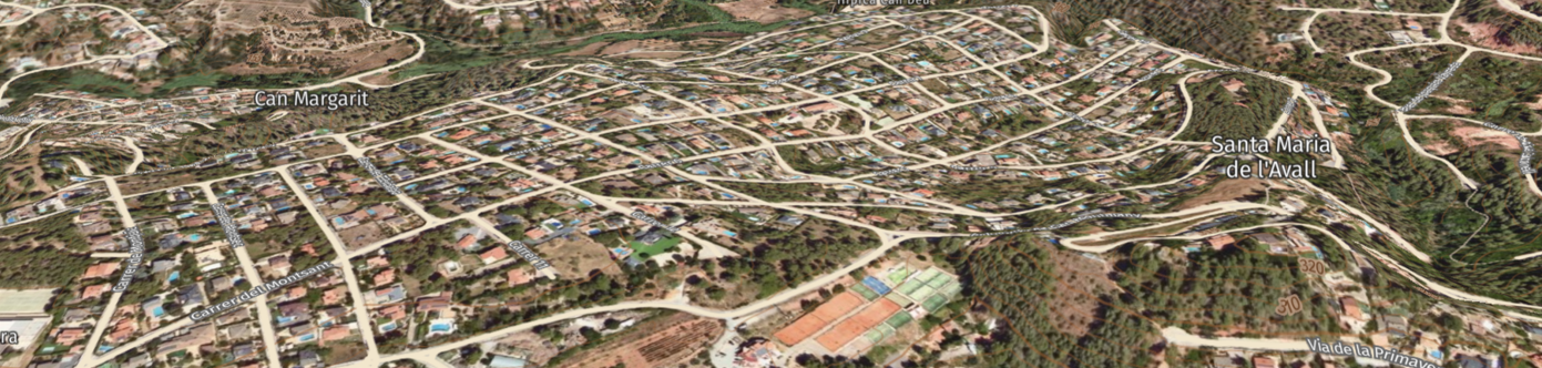
Given the lack of detailed information in the official project regarding which specific plots will be affected and unable to drain by gravity due to elevation issues (being below street level), we provide preliminary data on this crucial matter using Geolocation and Digital Terrain Modeling tools.
Simulation Methodology
This study is not based on opinions, but on a computational model using available public cartographic data. To prepare this preliminary report, we cross-referenced information using:
- Official Sources: Cartography from the Cartographic and Geological Institute of Catalonia (ICGC) and the VISSIR viewer.
- Digital Elevation Models (DEM): We extracted contour lines to calculate the theoretical height difference between each plot's platform and the projected street level.
- Cross-Validation: Comparison with satellite imagery and the available drainage plans from the GESA project (2024).
Analysis Results
25% OF THE PLOTS MAY REQUIRE PUMPINGThe simulation estimates that approximately between 80 and 120 homes have a compromised drainage elevation compared to the projected collector.
Technical and economic implications
The official project acknowledges the existence of plots that will need pumping, although it does not specify the final list in the public report. If a home is in this situation, the conventional sewage project implies additional considerations:
- Installation Cost (CAPEX): Need to install a domestic pumping station, tank, and electrical adaptation.
- Maintenance Cost (OPEX): Recurring energy expense and lifelong maintenance of an active mechanical system.
Study Conclusions and Recommendations:
- The sources used (ICGC, IDEC, Google, IDEC-ICGC viewer) are official and valid for relief estimations, although they do not replace the precise topographic data of the executive project on-site.
- It is strongly recommended to publish the final topographic surveys and connection elevations to allow independent verification by each owner.
- Until such official data is available, this report constitutes a preliminary technical evaluation aimed at identifying risks and costs derived from the local orography, so that decision-making is as informed as possible.
Ref. IT-TOP/AVALL-2025/02